By David Western, Victor N. Mose, David Maitumo, Immaculate Ombongi, Sakimba Kimiti, Winfridah Kemunto, Samson Lekanaiya, Paul Kasaine, Sunte Kimiti and Julius Muriuki
Introduction
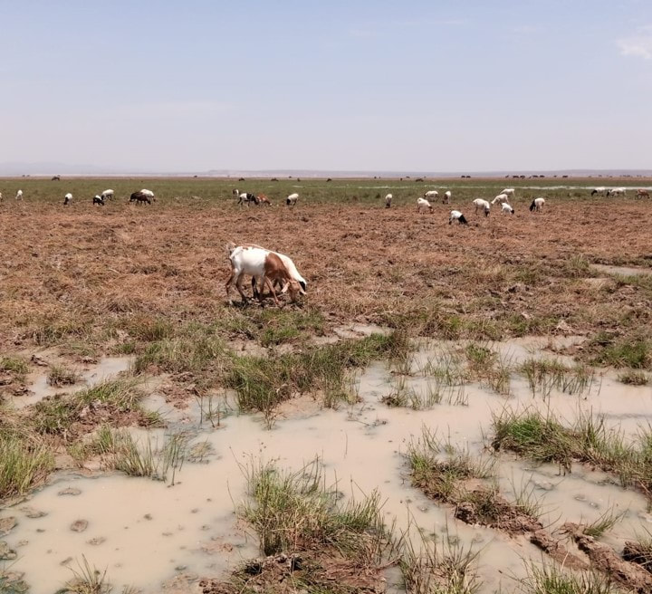
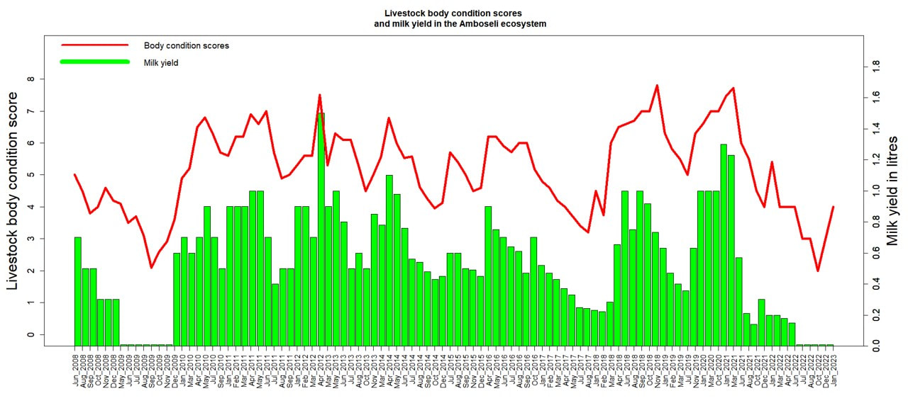
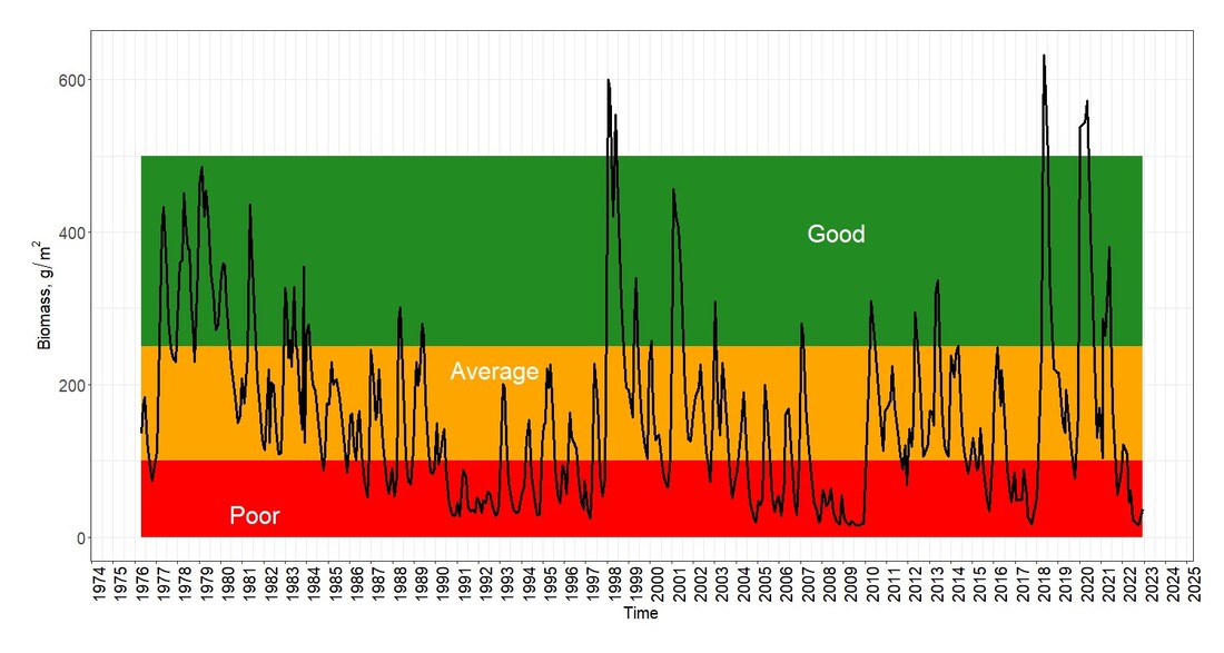
This ACP report is one of our regular series tracking the conditions of the rangelands, pastoral economy and wildlife in Amboseli. We also give pasture conditions across the southern region from Narok to Taita-Taveta which may dictate cattle movements across the region this dry season.
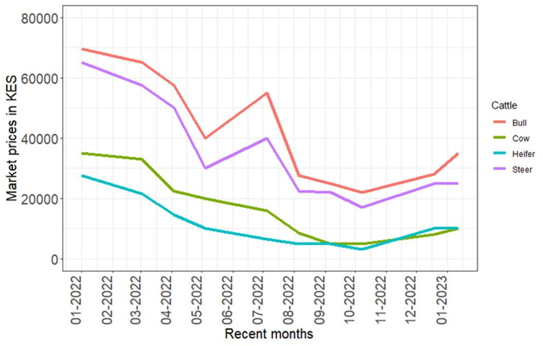
Our report shows that pasture and livestock conditions have not recovered sufficiently with the long rains to avert harsh conditions until the short rains late in the year.
Introduction
This ACP report is one of our regular series tracking the conditions of the rangelands, pastoral economy and wildlife in Amboseli. We also give pasture conditions across the southern region from Narok to Taita-Taveta which may dictate cattle movements across the region this dry season.
Our report shows that pasture and livestock conditions have not recovered sufficiently with the long rains to avert harsh conditions until the short rains late in the year.
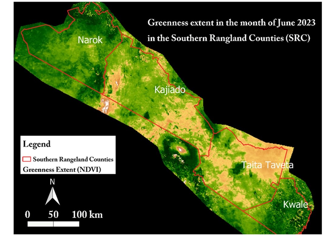
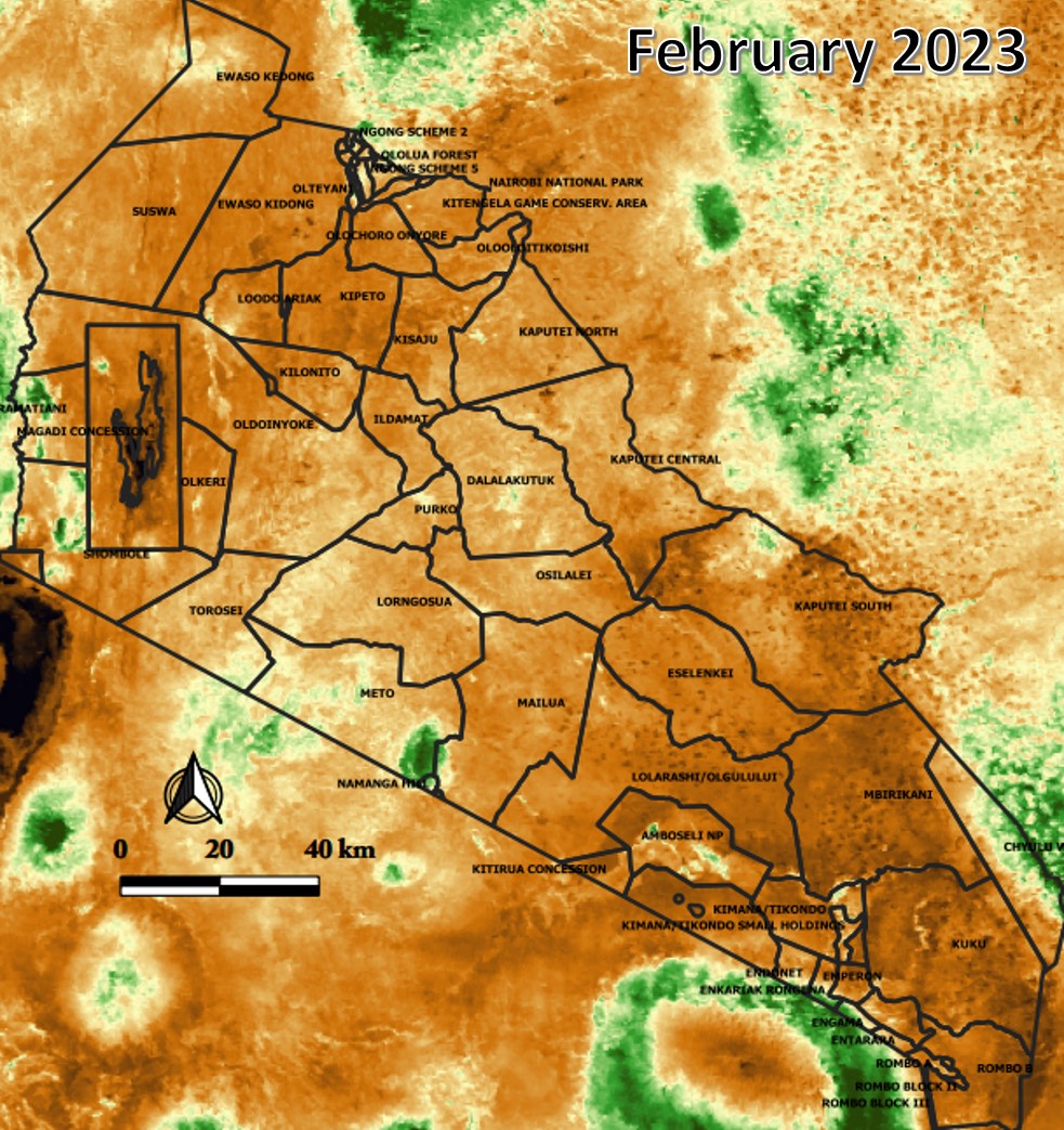
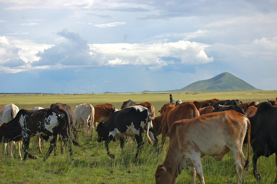
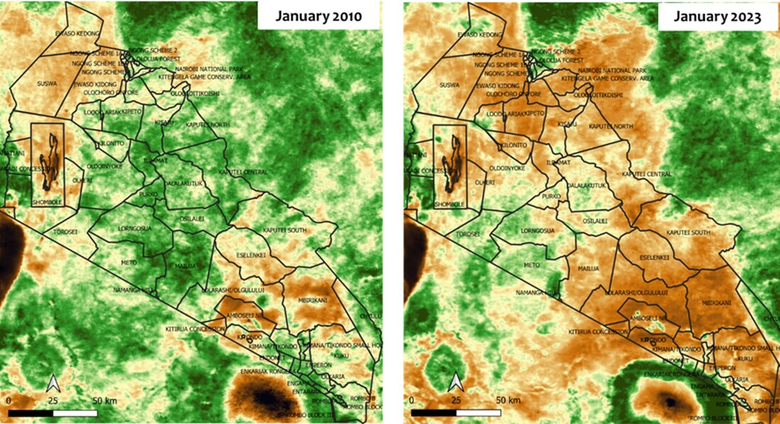
Figure 1:Sections of Kajiado around Amboseli and South Rift as well as parts of Taita-Taveta are already suffering pasture shortages. Many Kajiado herders are shifting to neighboring Narok in search of sufficient forage.
Download full report below.
| amboseli_post_drought_report_acp.pdf |

 RSS Feed
